Monday, July 29, 2024

The idyllic Grahams Island Campground, in Devils Lake North Dakota.

We’re fully engaged in our 4-month trip to explore the Northern Rockies as we entered North Dakota, a state that neither Judy nor I have ever been to before. We’re pretty far north in the US, someplace around the 48th parallel. The days are longer! (I’m sure the winter days are shorter as well). That’s farther north than northern Maine, or even Seattle, Washington. The countryside is quite flat, and most of what we see are miles and miles of farm fields. And as the rest of the country suffers through a heatwave, we have managed to evade the worst of the heat, experiencing very warm days, but substantially cooler nights.

We’re staying at a state park on Grahams Island in the heart of the Spirit Lake Reservation. This Reservation is the domain of the Devils Lake Sioux Tribe, which, in the last 20 years, has been further clarified as descendants of the Mni Wakan Oyate tribe and recognized by the federal government. This stop gave us quite an education on the life of Native Americans in the latter half of the 19th century. European settlers and the American government at the time exploited the Native American population, expanded territory, forced the relocation of thousands, and broke many treaties in which Native Americans relinquished land for money, peace & security. One cannot help but be affected by the injustice illustrated in these museums about the plight of the Native Americans. There’s a common thread that seems to weave its way through our travels. That theme being “man’s inhumanity to fellow man”.  Moving on.

The town of Fort Totten is just one of those places we visited where Native Americans were forced to give up their heritage and culture in order to assimilate into European civilized society.  Fort Totten is a small town on the other side of Devils Lake, and the town is named after the US Army’s initial garrison of soldiers trying to keep the peace between the newly arriving, land-hungry European immigrants and the Indigenous Indian population. In the town of Fort Totten sits the original military outpost also called Fort Totten. The military post was built in 1867 and used continuously as a military reservation until 1890. Fort Totten, the military fort, became a Native American boarding school.  A terrible place to send a child. For more than 80 years, spurred by federal assimilation policies beginning in the early 19th century, Native American children were sent to schools like the Fort Totten boarding school, and in some cases, they were forcibly removed from their homes. Not allowed to speak their native language, every effort was made to remove the Indian heritage from the children. Many children faced beatings, malnutrition, hard labor, and other forms of neglect and abuse. Some never returned to their families. Some ran away, never to return. The schools were organized as military style trade schools, designed to teach skills like sewing, leather work, agriculture, carpentry, printing, and cooking. The popular guiding principal of the time was to “Kill the Indian in him and save the man.”  If this sounds like an ugly policy, well, it was. Honestly, we were a bit upset and dismayed at the cruelty shown to those innocent children. In the 1930’s the treatment of the children and the objectives of the school changed significantly and was more in line with modern educational principles. The Fort Totten Boarding School eventually closed in the 1950s. We spent a while at the museum and eventually museum personnel tracked us down in one of the buildings to let us know it was time to leave, as the museum was closing.

Historically Accurate Commissary at Fort Totten
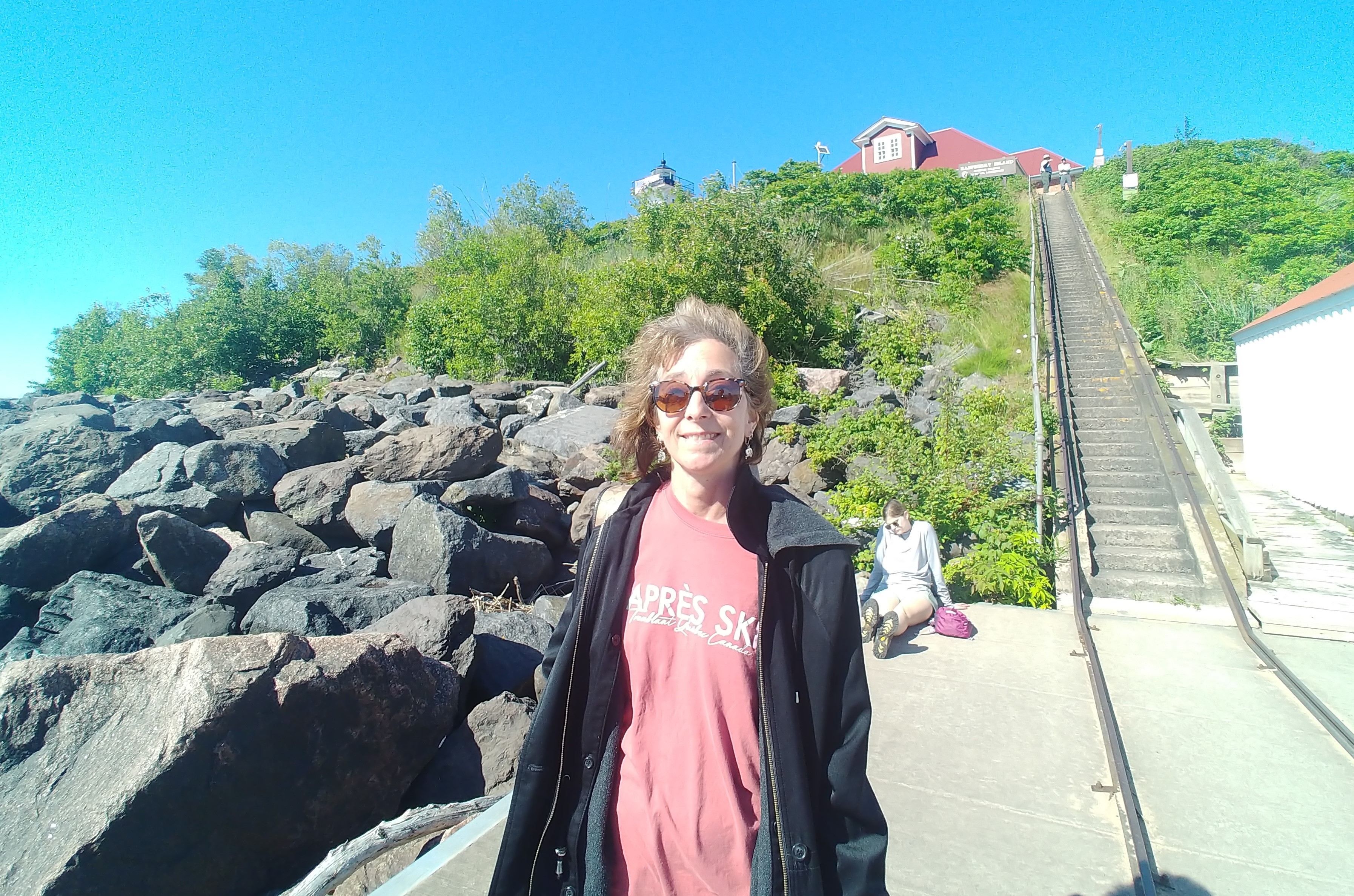
The Grahams Island Campground, on Devils Lake, where we are staying, is probably one of the nicest state parks we have visited so far. My gosh, this area is beautiful! There is a lot of boating, and I understand the walleye, perch, and northern pike fishing is outstanding. And it must be, because the state park has a couple of fish cleaning stations and they were very, very busy. The park’s rolling hill landscape was covered with great shade trees, and there was a beach on the lake for swimming. Primarily, what we thought was so fantastic was the space we had at our campsite. During the week the next closest occupied campsite was probably 200 feet away. We had some lovely nights by the campfire, and we had enough space to stretch out the hammock between two Cottonwood trees.  And the “price paid” for the space to relax was the approximately13-mile drive to get to, what anyone would consider, civilization.  And that civilization was the City of Devils Lake. 


We spent a very hot day wandering the 5-block area known as the town center. There were a couple of museums on our radar, and we needed to find the post office, so we parked the truck and started walking. The best museum in an air-conditioned building was the impressive old Ramsey County Courthouse building which held the Lake Region Heritage Center. This place was one part museum, and two parts a collection of town artifacts and antiquities strewn across the building, loosely arranged by subject. What was so unusual is that we were encouraged to touch anything we wanted and to take a closer look. For example, we were allowed to flip through a collection of the town newspapers from 1942. Very delicately so as not to disturb the newsprint. There were some really interesting historical articles about the war effort and war bond purchases as well as a slew of agriculturally based advertisements. And there was this disturbing yet intriguing article about cows being born, one inside out and one with two heads.

Take a look at the short clip of Judy operating and listening to a 1914 Victrola. The music is a little foreign to us, but the 110-year-old contraption was initially hand cranked before the album played.  All in all, a very interesting county historical museum.


We were not done visiting county historical museums. Devils Island is located in Ramsey County, and across the lake lies the town of Lakota, which is in Nelson County.  The Historical Society of Nelson County operates a make-believe town called “Stump Lake Village Pioneer Museum”.  This historical museum had a bit of everything. Old cars, chuck-wagon from the old west, tons of old farm equipment including a large collection of antique tractors, most of which were still working.  This county had preserved an entire dentist office from the 1940’s.  As you will see below, I stepped into a phone booth to make an important call on my cell phone.  LOL.

Telephone Booth Stump Lake Village Pioneer Museum

Stump Lake Village Pioneer Museum Antique Barn

Sitting on an Antique Tractor

Sitting in Caboose railcar at Stump Lake Village

There is so much to chronicle from our stop in Devils Lake, ND, including an excursion to a nature preserve and an encounter with a herd of Bison. But my word count is growing, and there’s only so much my readers can take.😉   So I’ll close with just one more tale of adventure.

There is a certain pleasure in stumbling into an establishment, on a whim, at a propitious time, and discovering something new. It can be a “hit or miss” experience, but we found a big hit in Devils Lake. It was a very hot afternoon and we walked through the city center, trying to stay on the shady side of the street. We passed an interesting Micro-Brewing storefront, and it looked like it had just opened for the day. The space was airconditioned and we were well in need of something cold to drink and a snack. Upon entering we were met by the owner and brew master of Black Paws Brewery, and his oversized Newfoundland dog, Marco.  And, gosh darn it, Marco, was just an adorable, big, lovable dog.  We were encouraged to sit at the bar as we were the first patrons of the afternoon, taste some micro-brewed beer and seltzer, and try the brisket nachos.  We lost track of time as we talked with the owners and the other patrons who filtered in slowly through the afternoon.  It was wonderful and we got some great suggestions on thing to do. The best suggestion we got was from a young man sitting at a table behind us about the local theater company putting on a play in the outdoor theater in Devils Lake. No big surprise here, we went!  Got to see the “Wedding Singer”, a musical, performed by the local summer stock theater company, at a delightful outdoor stage with lawn seating. Now that was a win, and then another win!  Grahams Island State Park was a relaxing and enjoyable stop.  Filled with sun, space, antique tractors, a couple of heritage museums, with a slice of theater on the side.  Let’s see what happens on our next stop, as we tell… the Rest of the Story.


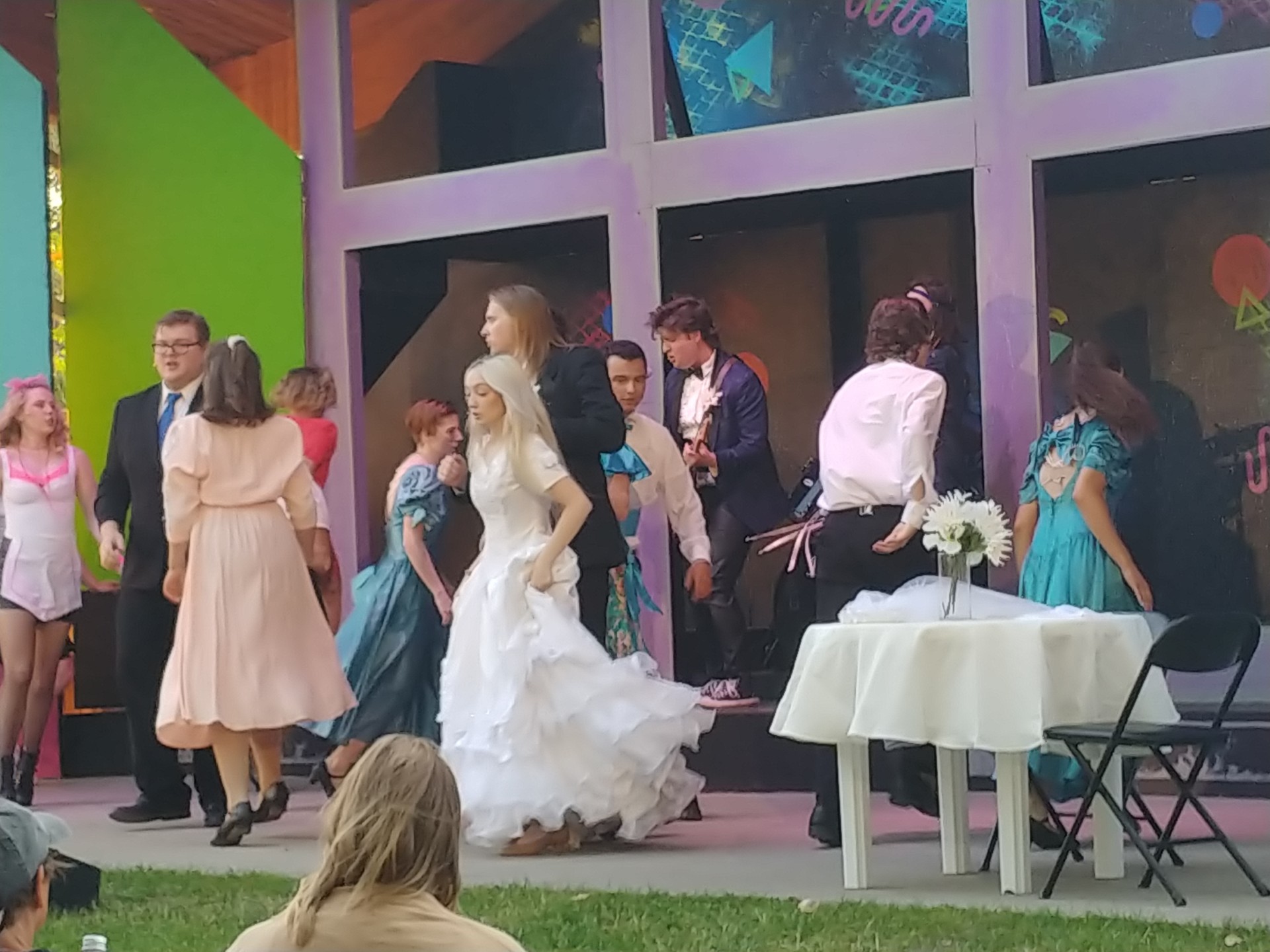
Fort Totten Little Theatre, The Wedding Singer


Monday, July 22, 2024

The Charming City of Duluth, MN and a visit with Paul Bunyan in Bemidji.

We left the town of Bayfield, WI and the Aposlte Islands and headed west, back into Minnesota. Our destination was the city of Duluth, on the western edge of Lake Superior. A city whose 19th century history and fortunes were founded in the booming lumber, wheat, and mining industries. Duluth is really a port city; a freshwater port, but a port none-the-less. So much of the vibrancy and charm of Duluth are the result of its port city traits. Many of the recreational activities revolve around the water, and the city’s infrastructure is based on shipping and the well protected natural harbor. So let me explain what I mean by that.

One of the first trips into the city had us headed for a piece of infrastructure uniquely associated with Duluth. That would be the impressive Aerial Lift Bridge (an aerial lift bridge opens by raising the entire span, from both endpoints). The bridge spans the Duluth Shipping Canal which is a mile long channel that allows ships access to the inner harbor. Flanked on both sides of the grand bridge is Canal Park, with both a south and north channel pier and lighthouse. Both piers can be walked, and both provide stunning views of Lake Superior. It is quite impressive to be standing near the bridge, watching the roadway rise to let an enormous cargo ship pass.

Aerial Lift Bridge going up

Attached to Canal Park is the 8-mile-long Duluth Lakewalk, which is a paved trail stretching from Bayfront Park to Brighton Beach. Much of the walkway is along the Lake Superior shore, as well as an active railroad line. The entire day was spent strolling along the piers and walking over the bridge, and then hiking the Duluth Lakewalk path. How convenient it was when we stumbled upon a noted Duluth landmark, Fitger's Brewing Company building. Rising above our lakefront walk, with a tall brick smokestack emblazoned with the name Fitger’s, was the hard-to-miss building. The building was re-developed by a group of prominent Duluth businessmen in 1984 and is now a luxury lakefront hotel and shopping area. The ice cream and covered picnic table were just the respite we needed after walking along the Duluth waterfront all morning and most of the sunny afternoon. 

North Pier of Duluth Shipping Channel

Americans collect a lot of stuff, and as we travel across America we have found that many a historical society, or some such organization, eventually acquires and displays those antiques and collectibles in a museum. These collections are usually most interesting & impactful when they include the provenance which captures the ownership history of a piece all the way back to origination. Viewing these artifacts in the original surroundings can be a surreal experience. Like you’re being carried back in time and history. The better preserved an artifact, the greater the WOW factor. Glensheen Historic Estate is one such place, with amazingly preserved artifacts, inside a restored mansion. The mansion is 20,000 sq feet and the estate is situated on 12 acres of pristine Lake Superior shoreline. The house was built between 1905 to 1908, and the grounds literally remain as they were when Mr. Chester Adgate Congdon and his family lived there from 1908 until the building and grounds were given to the University of Minnesota in 1968. The original furniture brought into the house in 1908 and '09 remains in virtually the same place it has been for 110 years. Some of the wall coverings and upholstery are also original. Elisabeth Congdon (Chester Congdon's youngest daughter) was given a life estate, allowing her to occupy Glensheen until her death (well, actually her murder) in the mansion in 1977 (that’s a whole other story you can google if you want). The home cost a total of $854,000, equivalent to more than $22 million in 2017. The home is a crowning example of design and craftmanship of the Midwestern United States in the early 20th century. Touring the home and grounds was only the first part of our day.

Glensheen Historic Estate

The second part of our day required us to drive less than ¼ mile from the historic mansion to, if you can believe it, Congdon Park. Located along Tischer Creek, the park features some of the most pristine hiking trails in Duluth. It was developed in 1908 on land donated by Chester Congdon, who was then building his Glensheen estate. The creek runs through the property, and he gave Duluth the park land and paid for its development on the condition that the city would stop using the creek as an open sewer. We hiked a good couple miles of the park before returning to our vehicle and heading back to our campsite for July 4th firework festivities.

Walking the Trails of Congdon Park


What would a stop in Duluth be without a train ride?  We enjoy a train ride, and have even been on a dinner train, and trains are a great way to see the countryside. This time our train ride was on the Lake Superior & Mississippi Railroad (LS&M) along the St. Louis River Estuary and Spirit Mountain. Boarding the train in Duluth and taking a ride 17 miles south through bogs and estuary with the track literally running over the water was amazing. The scenery was breathtaking, as we sat in the open-air railcar enjoying our 12 mile per hour ride.  A great morning excursion.

Lake Superior & Mississippi Railroad (LS&M) along the St. Louis River Estuary 

We enjoyed Duluth a great deal.  Lots to do and see.  However, we are on a mission to explore the northern Rocky Mountains and needed to continue our journey west. There were many miles to cover before arriving in our next state, North Dakota, where we would be staying in a state park campsite. Too many miles away for a day’s drive, so we made one more stop in the state of Minnesota, a small town called Bemidji, the first city on the Mississippi River after its origins in Lake Itaska. Located less than 50 miles downstream, Bemidji Lake crosses the Mississippi, meaning the Mississippi River flows both in and out of the glacially formed lake.  We spent a morning walking the park and trails around the lake, and even spotted a bald eagle in a tree.


But easily the highlight of the stop in Bemidji was finding Paul Bunyan and Babe the Big Blue Ox!  Finally, I had found the quintessential side-show attraction that I had envisioned when depicting our RV travels. Bemidji is the self-proclaimed birthplace of Paul Bunyan. You remember the legend of Paul Bunyan, don’t you?  He cleared forests with one swing of his ax. He and his trusty bovine, Babe the Blue Ox, dug the Great Lakes to quench the thirst of his fellow loggers. He created the Mississippi River by simply dragging his ax behind him. An 18-foot-tall statue of the legendary lumberjack and his beloved blue ox, Babe, have been standing near the lake and attracting kitsch loving photo takers, like me, for 85 years.  I’m so proud to finally be here!!


Just 8 stops into our adventure and we’re already visiting places jam packed with interesting and exciting activities, museums, and state parks.  At this rate I’m destined to pull a muscle in my jaw constantly picking my chin up. The benefit of traveling and staying in places for a week or so is the ability to get close to the community.  And I’m mildly amused at the reaction I get when I tell people we meet that we’re visiting from Massachusetts.  Like we’re a species that they were not expecting to bump into.  Predictably, my accent gives us away almost immediately. Let’s see what we find on our next stop, when we visit the state of North Dakota for the first time. Leaving Bemidji, MN and heading due west to the north central part of the state, a place called Devils Lake. We have reserved a campsite in Graham’s Island State Park. My trip research indicated that this was a special campsite and we’re really looking forward to our experience as we tell… the Rest of the Story.


Friday, July 12, 2024

A visit to Bayfield, WI the gateway to the Apostle Islands.

When our forefathers were formulating state boundaries, a beautiful but small swath of land that abuts Lake Superior became part of Wisconsin. Most of the border that separates Minnesota from Wisconsin is the result of a river. In the southern part of both states, the Mississippi River facilitates the state boundaries. Where the Mississippi and St. Croix Rivers meet, southeast of Minneapolis, the St. Croix River defines the state border.  Skip up to the north at Lake Superior, and the headwaters of the St. Louis River separates the states. For some fortunate reason, a rather large tract of land called the Bayfield Peninsula, which includes the towns of Red Cliff, Bayfield, Washburn, Ashland, as well as the gorgeous Apostle Islands, became part of the state of Wisconsin. How fortunate was Wisconsin? Very!! In 1970, when Congress named 20 of the islands and 2,500 acres of the peninsula as a national lakeshore managed by the National Park Service, the area became a vacation magnet. Bayfield, WI became the gateway to the Apostle Islands, with plenty of ways to explore the great outdoors and the beautiful Lake Superior shoreline.  And that is where we camped after leaving Wabasha, MN, the amazingly quaint Bayfield, Wisconsin.

If you’re personally familiar with me, then you will already know that I’m a bit of a “foodie”.  We found Bayfield harbor cram packed with fishing vessels, and indeed this area is known for both recreational and commercial fishing. Freshly caught fish, such as whitefish and trout, are brought in daily, and processed locally.  Day number 1 in Bayfield and I’m already shopping at the “just off the boat” fish market. I bought fresh trout, which I froze and will use with a seafood stuffing at some time in the future. But what I really want to talk about is the honey smoked whitefish. Ohh my g-d, just amazing! Before there was that over processed “white fish salad” that you can get at your local Costco or BJ’s, there was real smoked whitefish. What memories the taste evoked. Crazy right? I was immediately reminiscing about my childhood in Brookline, Massachusetts. My grandfather would attend temple services on Saturday morning and then after services, he would stop by the local deli and pick up fresh bagels, cream cheese, salted lox, and, if we were lucky (the deli had not run out), smoked white fish, bone in, but head removed (My mother insisted that the head be removed, she did not like the fish staring back at her). We would be seated at the kitchen table, clustered around Mom as she carefully removed the bones, and delivered smoked whitefish to my “bagel with a smear”.  I haven’t tasted smoked whitefish like that in quite some time. This will be my new morning breakfast ritual for as long as the whitefish supply remains.

The Bayfield Peninsula and the Apostle Islands are just so active and vibrant, that there was no shortage of museums to visit, sightseeing to do, and excursions to take. And of course, Judy performed her “due diligence”, and had a notebook full of information on walking trails, activities and attractions. Mother nature even cooperated and gave us a couple of really nice days to explore the area. Narrowing down the list and highlighting the most enjoyable expeditions is going to be a bit of a challenge. We’ll do our best, and detail them in chronological order. 

Day #2 

We loaded our backpacks with bug spray, lots of water, our lunch, and drove 15 miles north, across the peninsula to a remote section on the water called Meyers Beach. We were looking for the Lakeshore Trailhead which would lead us into the Apostle Islands Maritime Cliffs State Natural Area. The website All-Trails® considered this a moderate hike, almost 5-miles out and back.  The trail started along a boardwalk which kept our feet out of the worst of the mud conditions. Then, up and down and over, traveling a path of tree roots and rocks until we reached the outer rim of the shoreline and the amazing caves. 

Judy at the Maritime Cliffs 
Sorry the pictures do not fully explain how unique and beautiful these caves are. The entire shoreline is made up of a reddish-brown sandstone formed millions & millions of years ago and, over time, Lake Superior waves, along with wind and ice, have sculpted the exposed sandstone cliffs into sea caves, vaulted chambers, arches and pillars. While walking along the shoreline trail it is easy to hear the splashing of the waves against the sandstone 30 to 50 feet below. There was a wonderful spot to stop for lunch at the ½ way point, taking one last look at the unique features cut into the exposed sandstone cliffs. Magnificent!


Steven & Judy in front of cave on Lake Superior & Maritime Cliffs 

Day #4

Going to sound like a little bit of a” broken record” here when I say, “we again packed a couple of backpacks”, and got an early morning start driving to the Bayfield docks to catch a ferry to Madeline Island. A pleasant 30-minute ferry ride on a beautifully sunny morning. These ferries run very regularly in the summer and carry cars, trucks, bicycles, and people back and forth to the island. Our intention was to explore Madeline Island on foot. The town center is called La Pointe, which is a small vacation-oriented town center with a handful of shops and eating establishments.  The population of Madeline Island in the wintertime is 220 and, in the summer, it balloons to 2,500.  When Lake Superior freezes there is an ice road route to the island. There are certain times of the year when weather conditions make travel to the island rather difficult, if not impossible. We walked almost 6-miles of the entire 43-miles of roads, including the 1.3-mile-long Casper Trail through the center of the township. The trip would not have been complete without a look inside the Madeline Island Museum. For a seasonal community and small town, there was a lovely and informative historical museum which really outlined the Native American citizens and occupants of the Bayfield Peninsula and the Apostle islands.  As it was getting close to 3:00 we headed back to the ferry terminal to catch the ferry for our return to Bayfield.  

Judy & Steven on Casper Trail, Madeline Island, WI

Day #5

Lest you think that we’ve given up on visiting lighthouses, nay, nay!  I can assure you it’s only because our most recent travels have had us in land-locked states. The Apostle Islands are a mecca for lighthouses, with eight of them placed on six of the islands. Judy and I picked an excursion to the Raspberry Island Lighthouse located on…Raspberry Island. One of the smaller islands of the archipelago, the history of Raspberry Island centers on the lighthouse, which served to guide steamships through the west channel between the lighthouse and the mainland. The lighthouse, located on the southern part of the island, has been preserved and manned by the National Park Services and volunteers since 1975. The entire compound and all related artifacts have been remarkably preserved and/or restored as originally built.  As if this was 1902. The preservation went so far as to continue to display a rack of 1950’s era lead acid batteries used to power the foghorn and store power from the diesel generator (also still on display). The lighthouse is not very tall, only 77 feet from base to light, but the entire compound sits up on the island bluff, which is about 44 feet above the boat landing, or an 88-stair climb. The first thing you notice when exiting the boat on the boat landing pier are the tramway rails that were first installed in 1902 to haul construction materials and coal to the top of the bluff. And the tram is still in use today some 123 years later. The whole island provides breathtaking views of Lake Superior and was just a lot of fun to visit. The sun was strong, and the winds were warm, as we rode the 50-minute ferry ride back to the Bayfield dock.  A great excursion!  Lighthouses are back, at least temporarily. 


Raspberry Island Lighthouse
A top the Raspberry Island Lighthouse

We had a great meal at the "Good Thyme Restaurant", about 10 miles down the highway from our campsite towards the town of Washburn. We also did some hiking locally, where we walked from the campsite to a well-known trail along the Lake Superior shoreline called the Brownstone Trail, on which we saw some stunning “lakeside” houses and mansions that abutted the lake. Unfortunately, just too much activity to try to post about. All great stops must come to an end, as did this stop in Bayfield, WI. Some places we visit just leave us wanting to stay just a bit longer. But we move on, because around every corner there’s another journey and something new to see or do as we tell… the Rest of the Story.


Friday, July 5, 2024

Witnessing the mighty Mississippi River flooding Wabasha, MN

After 10 days of travel and just over 1,300 miles, we arrived at Big River Resort in Wabasha, MN. The kickoff location for our exciting adventure through the northern Rocky Mountains and on into Colorado. This is a familiar place, as we were here just about 10 months ago. Last year, this was as far west as we ventured. We had spent time visiting the midwestern states of Ohio and Missouri, and by the time we had gotten to Wabasha, Minnesota, it was time to start heading east. This trip is different!  Very different.  When we leave after a week, we will just be starting our western adventure. 

Wabasha is the first small town that we decided to return to for a second visit. There’s a lot to be said about visiting a place for a second time and already being familiar with the area. I guess you could say that the other reason we picked Wabasha is so that we could visit with friends, Kristine & Bryan. Having camping friends means that schedules can be coordinated to connect again, and that’s just what happened. Just like last year, we had another couple to hang out with, go bowling, and socialize over a number of dinners. 


Kristine & Bryan are native Minnesotans, so at their suggestion we all went to visit a town about 30-miles north called Red Wing. The home of Red Wing Footwear.  For over 100 years, Red Wing boots have been built with construction techniques that transform premium materials into supremely durable boots and shoes. Their flagship store showcased a great variety of shoes, as well as being a museum that shared the Red Wing Footwear history.  We did do some shopping in the basement in the mark-down discount section, but to be honest, neither Judy nor Steven requires work footwear anymore.  We did get our picture with Red Wing’s most iconic (and oversized) work boot.


Using Wabasha as a home base we roamed around a good amount, traveling north to Red Wing, but also heading 30-miles south to visit the town of Winona.  Winona is the home of the Minnesota Marine Art Museum.  An expansive museum offering classic & contemporary marine-themed paintings & sculpture, plus a garden. The museum is located on the banks of the Mississippi River and boasts six galleries that showcase meaningful art experiences that explore our relationship with water.  I’m not sure what I expected to see when I first walked into the museum, but I did not expect to find such a moving exhibit by a New York born and Berlin-based photographer Mustafah Abdulaziz. His exhibit called “Water” captures the compelling narrative of climate change's profound impact on humanity.  If you ever have a chance to see pictures or exhibitions by Mustafah Abdulaziz, in a gallery setting, I encourage you to do so.

Much of what we concern ourselves with lately has been the weather.  And not all the weather, just the weather that affects our activities. Which is a bit strange because our zip code seems to change every week by about 300 miles. That being said, we never checked on the weather conditions in Wabasha, and maybe we should have. Wabasha is on the mighty Mississippi River and that river is flooding in Minnesota. Dams across the state are at capacity, some have over-run the tops, and some of the locks which allow barge traffic to negotiate the change in water elevations, have been left in the open position. Docks have floated away, and towns along the river are flooded. Wabasha was no exception. We were shocked to see the river riding so high and fast.  Most mornings we walked with Kristine and Bryan through town, as we monitored the slow rise of the river.  This is a picture of Judy and me sitting in an oversized Adirondack chair which pays tribute to the “Grumpy Old Men” movie (portions of which were filmed in Wabasha).  This picture was taken on Sunday, June 23, on our morning walk through a small park just out of the center of town. Note the river in the background.


Just one week later, on June 30th, Kristine forwarded the following picture of that same Adirondack chair. The oversized chair is partial submerged by the flooding river.


WOW is all I can say.  I’ve never experienced a river as large as the Mississippi flooding before.  Streets have been sandbagged, power has been shut off to affected areas, and sewer systems have been sealed. And it’s not just the Mississippi that is flooding. We tried to take a hike through the Zumbro State Wildlife Park and the area surrounding the Zumbro River. The Zumbro River is a tributary of the Mississippi, and the hiking trails were just 14 miles away in the adjacent town of Kellogg (no relation to the cereal manufacturer). First, we tried the north parking fields. The road was closed due to the flooding of the river.  We were determined, and had the time, so we drove 21-miles around the park to the south side entrance, only to be stymied as well. The entirety of the over 1,000-acre sanctuary was inaccessible due to flooding. That’s what we call, when we’re sight-seeing, “a swing and a miss, with good effort.”

Ironically, our last day in Wabasha was clear, mild, and brilliantly sunny, and we had hoped that the comfortable and dry conditions would continue after our departure, with the promise of relieving the flooding across the Mississippi River. Ultimately, we found out from our friends that the river continued to rise and crested a few days after our departure.  We left Wabasha over the Wabasha-Nelson Bridge driving north-east to the Apostle Islands in the state of Wisconsin.  It was time to touch the water of Lake Superior. Lake Superior is the 5th and last of the Great Lakes we have visited in the last year.  Find out what was so superior about our visit to Bayfield, WI and the Apostle Islands when you read my next blog post as we tell… the Rest of the Story.

Acadia National Park amazed us, and we also caught up with Paul Bunyan.

Strap yourselves into your travel chairs, we’re back on the road and we couldn’t be happier to be sharing our travel experiences with you. I...